The six most practical plugins for QGIS
Plugins give a boost to your work
Plugins are available for many purposes in QGIS and can add many new levels to your work! Plugins are additional functions developed for QGIS and they are developed by individual developers or, for example, by an independent company. Plugins can be used to extract building data from a specific area, to create interactive maps or to create an elevation model into a slope profile. Now we will look at some of the QGIS plugins favoured by Gispo workers and their various use cases. The main reason why we introduce these specific QGIS plugins is that we work especially in the Finnish geospatial data field. Can you find your favourite among the list?
DigitransitGeocoding
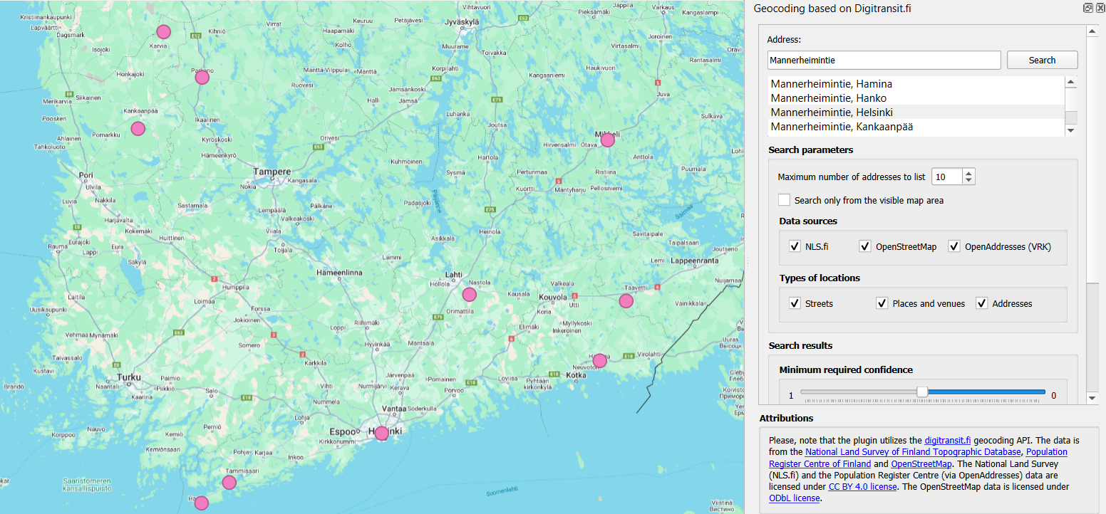
This plugin is intended for geocoding Finnish addresses and locations in the QGIS project. Geocoding allows you to conveniently search for different addresses and places in QGIS just by typing the name of the address or place you are looking for in the search field! To use this plugin, all you need is an API key, which can be easily obtained from https://portal-api.digitransit.fi/. To use the plugin, you need to create a global variable DIGITRANSIT_API_KEY in QGIS and set the API key to its value. More detailed instructions on how to create an API key can be found on the Gispo blog (written in Finnish). For example, in the image below, all roads in Finland with the name Mannerheimintie have been retrieved.

The address was retrieved with the DigitransitGeocoding plugin. The plugin creates a point layer of the address, making it easy to detect and visualize the address location.
Qgis2web
The Qgis2web plugin allows you to export your QGIS project as an OpenLayers or Leaflet web map directly into your browser. This plugin copies as many parts of the project as it can, including layers, scopes and different styles. The plugin also takes into account possible style classifications and grading when including styles. This plugin easily transfers your project to the browser, where it becomes a handy interactive map!

Interactive map of the noise pollution caused by the railway in the Helsinki city centre, transferred from the QGIS project to the browser using qgis2web plugin.
MapSwipeTool
This plugin allows you to compare two map layers. The map layers are superimposed on each other, allowing you to compare land use changes over different years from aerial photos, or the effects of flooding in a particular area before and after! The comparison is made by sliding the line in the middle of each map layer to the right and left, so that one map layer is always compared with another in the same area and the differences are quickly visible. This plugin is also useful for comparing georeferenced data, for example!

Comparison of aerial images of Helsinki in 2014 and 2023 using MapSwipeTool plugin.
Profile tool
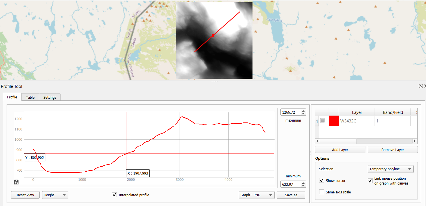
The Profile tool plugin allows you to draw a slope profile from your own elevation model in a QGIS project. A line is drawn on the graph to represent the height variations of the elevation model. As you move the mouse over the slope profile, you can see in real time where each degree of elevation is in the elevation model. A handy plugin to get all the information out of elevation models, for example for use in watershed analyses! The diagram can be saved as svg, png, csv or pdf files.

Examining elevation differences in the Lapland area using the Profile Tool plugin.
QNEAT3
With QNEAT3 you can easily perform a variety of geospatial analyses on your road network data. Whether you want to calculate the shortest route from point A to point B or create an interpolated surface from the distance between two points, this plugin has the tools to solve your toughest spatial data problems! The plugin includes tools for calculating the fastest or shortest route, as well as various Iso-Area analysis tools for creating point clouds and interpolation layers from road network data, for example.

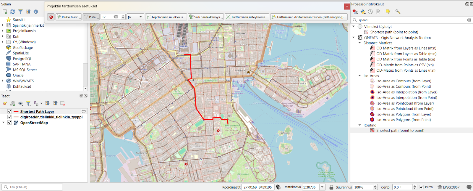
The fastest route from Helsinki Central Station to Tähtitorninmäki calculated with QNEAT3 plugin.
Psst! You should click the snapping tool active in the QGIS project to grab the road network layer. This will allow the plugin to calculate the route, for example, even in a situation where the starting point is in a forest far from the road network.
QuickMapServices
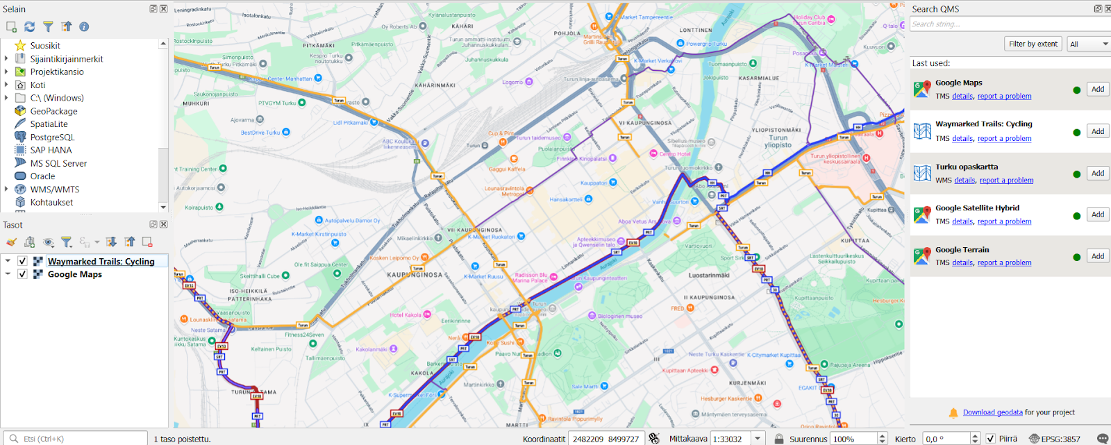
Still missing a suitable background map for your QGIS project? The QuickMapServices plugin is made just for this purpose! This plugin offers a comprehensive range of different background maps for your QGIS project. Whether you want a background map to match the background of your generated elevation model, or even a background for your spatial analysis to distinguish city roads and buildings. In this plugin you will find, for example, OpenStreetMap cycle route maps, City of Turku maps, Landsat satellite images and various Google maps. QuickMapServices plugin allows any individual or organisation to submit their own maps for publication via their website. Remember, however, that the license of the published material must be public if the map is to be included in this plugin!

Map of cycling routes opened via QuickMapServices plugin and Google Maps map in the QGIS project.
Plugins for every need
Plugins are available for many different needs and can be used for a wide range of different spatial data problems. Plugins are also being updated and developed in QGIS and this development can be done openly by many different actors and organisations. Gispo offers a wide range of courses on how to use QGIS plugins, as well as a dedicated course on plugin development! There are already a huge number of plugins available for QGIS, so it’s definitely worth getting more familiar with the handy features of plugins and actively following their development. So don’t hesitate to try them out!
